


4,8 km | 6,1 km-effort


Usuario


Aplicación GPS de excursión GRATIS
 SityTrail
IGN / Institutos geográficos
SityTrail World
El mundo es suyo
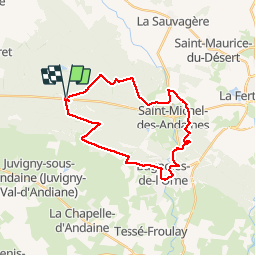
Ruta Bici de montaña de 25 km a descubrir en Normandía, Orne, Les Monts-d'Andaine. Esta ruta ha sido propuesta por tracegps.
Un des nombreux parcours balisés dans la forêt d'Andaines. Mélange de piste forestière et de sentiers. Très agréable et pas difficile. En plus, le passage à Bagnoles de l'Orne peut être l'occasion de boire un coup ou tout simplement de faire une petite pause. La partie entre Bagnoles de l'Orne et la croix d'Andaines est un peu plus sauvage sur des sentiers plus étroits mais bien tracés.

Senderismo
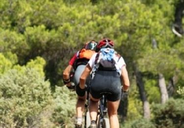
Bici de montaña

Senderismo
Senderismo
Senderismo
Senderismo
Senderismo
Senderismo
Senderismo